Kevin – Monday. With our reservation expiring at Crow Valley, and with the ever-increasing distance back and forth from end-of-day location back to Crow Valley, we take the morning to move the RV rig. Our next ‘temporary home base’ will be 60 miles north at Hawk Springs Recreational State Park – a reservoir with barely improved campsites. No hookups, but we’re getting used to going without for a few days.
We put in 188 miles this morning just moving the rig then backtracking to our bike start for the day. We drive the rig forward then return to Egbert. It’s nearly noon before we start biking and it’s getting hot. Over the years I’ve had a couple of bouts of heat exhaustion, so we are thinking about how to avoid these late starts. The heat isn’t nearly what we expect it will be later in the summer, so we have to get earlier starts.
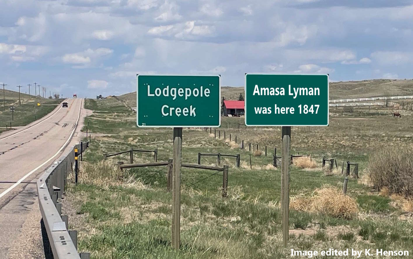
A few miles north of Egbert, we cross Lodgepole Creek. It was at Lodgepole Creek that Amasa Lyman and his escorts (Woolsey, Tippits, and Stevens) finally caught up to the detachments from behind. They’d missed each other on June 7th while the detachments were laying over a day on Crow Creek. Lyman’s group ‘lost the trail’ going south and crossed the South Platte lower down missing the detachments by only a few miles. Lyman realized the problem at St Vrain’s crossing and turned his group north, spurring their animals to try and catch the detachments- which they did at Lodgepole Creek.
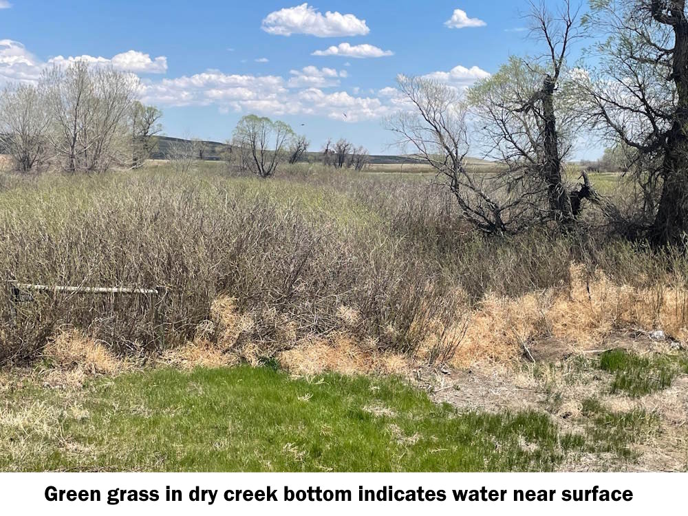
It’s safe to say that in the 1800’s more water flowed through some of these creeks they mention. With wells pumping water to grow crops, with decreased rainfall and higher temperatures, the water table has been lowered significantly. Crow Creek is one of those that no longer flows continuously.
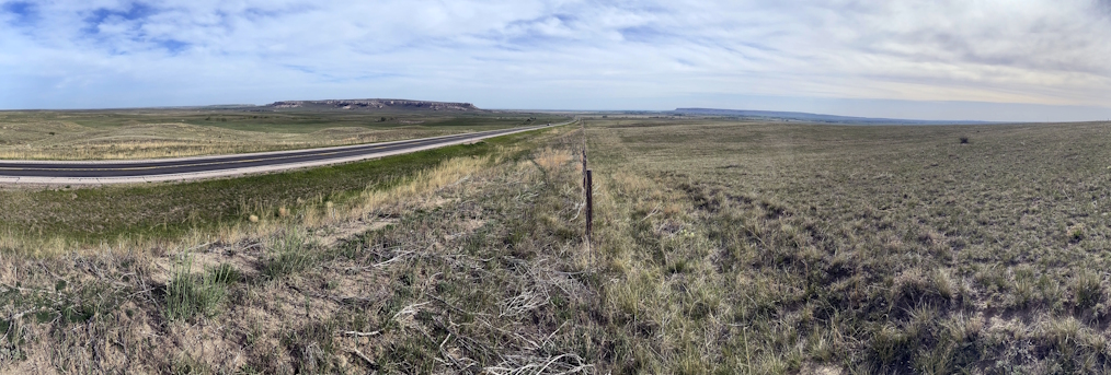
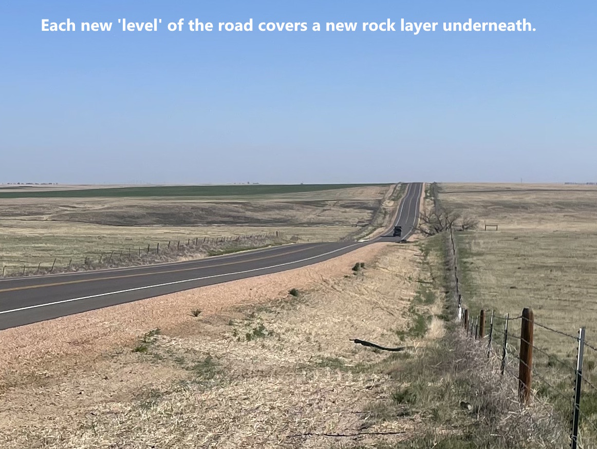
The route has been slowly but steadily headed uphill since we left Greeley. The roads go along fairly level for a-ways then ‘jumps’ 5 to 10 feet higher over a fairly short distance. It’s a new rock layer underlying the pavement and most of the time up here on the prairie, you can’t even see the new rock layer – but it’s there none-the-less. Each new ‘step’ up the rock column takes us higher. In total, we’ve gained about 1,000 feet elevation and we’re now about 5,600 feet above sea level, higher than Denver but not as high as the Pinery divide.
By mid-afternoon we’ve reached the intended stop for the day, the intersection of US Highway 85 and Colorado 213. HW-85 is the route between Cheyenne and Torrington (where we’re headed).
Why stop here? It’s the southern rim of Goshen Hole. Standing at the intersection, you’re at the top of the cliffs that define the rim. The expansive view to the north down into the valley with its semi-circle of surrounding cliffs and mesas is one of the most beautiful scenes I’ve encountered. I know. I know. The journalists say that every few days as they come upon increasingly beautiful vistas. But trust me. Goshen Hole is truly beautiful. A land of milk and honey. More about it over the next week or so.