Kevin – Saturday. Waking this morning, I was a new man. The rest, medications and Denny’s tender care did what was needed and now we’re ready to pursue some work that has been on my list for a few years.
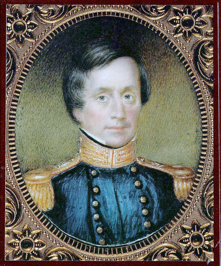
Though not a US military compound, Fort Laramie was THE major trading post in this area in the mid-1840’s. It was THE location around which key immigrant, military, native and Mormon events took place. Perhaps the most important was the 1845 South Pass Expedition headed by Col. Stephen Watts Kearny.
Part of our efforts with this trek is to correlate Kearny’s 1845 route, then compare and contrast it to routes used by the Mississippi Saints in 1846 and the 1847 routes used by the Mormon Battalion detachments. While not identical, they are related and play into the narratives. While this research is on-going, we can share a few insights which we hope will stimulate some thinking.
First: Kearny had an overarching task with his Expedition assignment; to prove the United States could project its land-based military force across the continent. The US Navy was already a force in the Pacific Ocean, but could the US Army really cross the continent quickly and remain a viable military force?
Second: In order to better understand his future strategic options, Kearny used TWO routes. He followed the North Platte River’s Oregon Trail outbound, but upon his return to Ft Laramie, he diverted, going south to the South Platte River, to Bent’s Fort on the Arkansas River, then returning to Ft Leavenworth via the Santa Fe Trail. This exposure for his Dragoons introduced them to a variety of environments, severely tested their, their animals and their equipment’s endurance and sharpened the thinking of his officer corps.
Third: These routes were widely known among the frontier residents, guides and natives. These same guides would be instrumental in directing the 1846 conquest of New Mexico and California, for directing the Mississippi Saints of 1846, the Mormon Battalion and its detachments in their travels.
The focus for us today is to roughly trace Kearny’s 1845 route south from Ft Laramie, then circle back onto what I believe was a trapper’s trail variant that led to Ft Laramie. So, here goes …
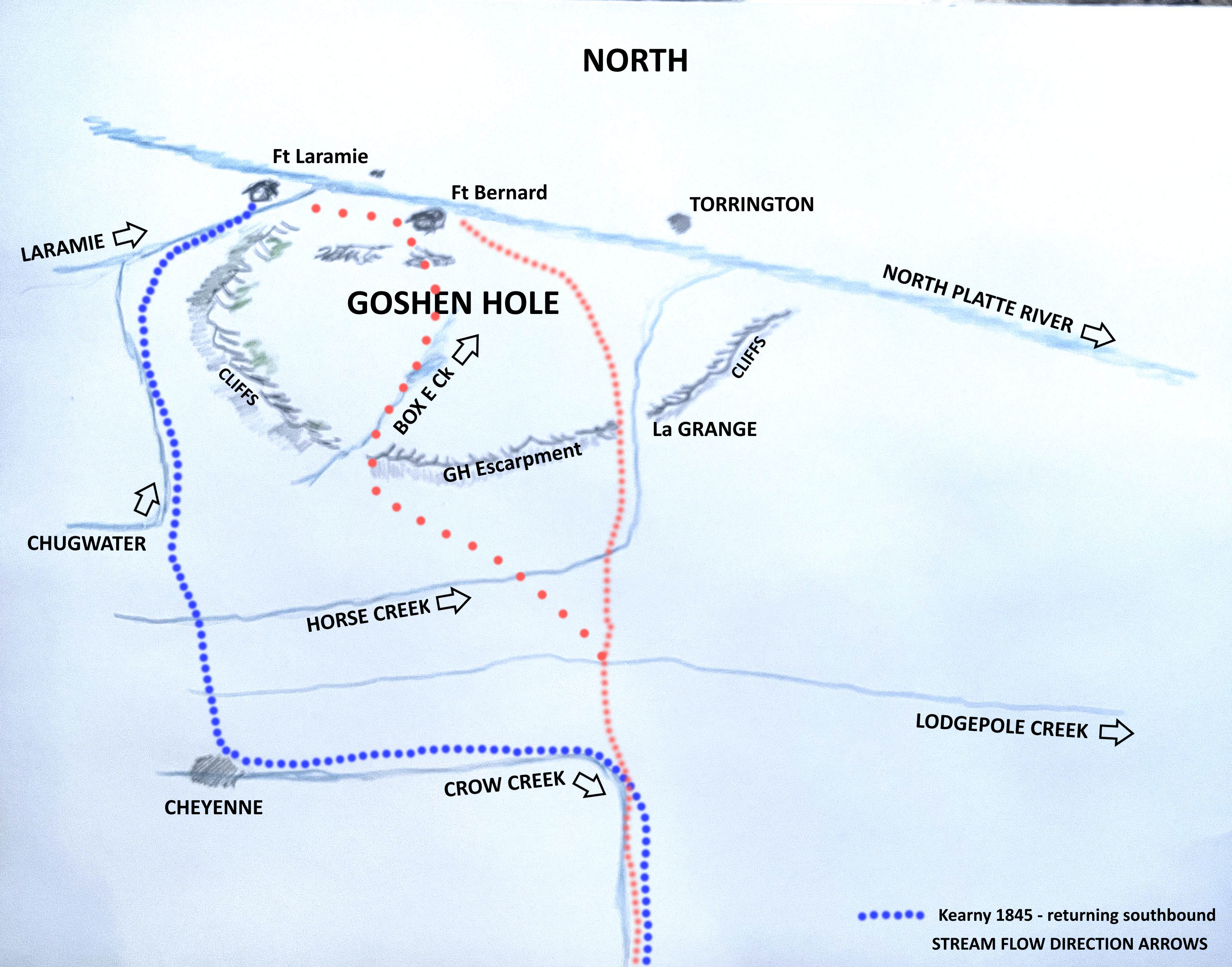
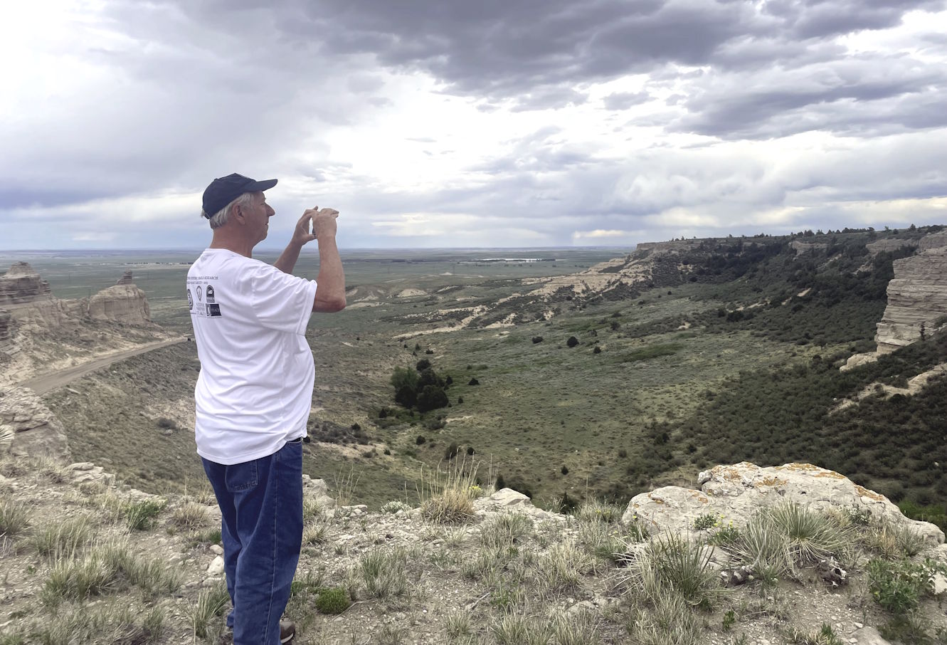
From Ft Laramie, we followed the Laramie River before switching over to Chugwater Creek. Look it up on WIKI. We followed that to the town of Chugwater where we turned up onto the high plains south of the Goshen Escarpment. The most breathtaking site we are likely to encounter on this entire trip was to stand on the rimrock cliffs and look out over the Goshen Hole. You can easily see over 100 miles and it’s magnificent. The detachment’s stolen horse recovery team likely followed one of the canyons down into the Hole at or near Box Elder Creek.
This sketch map will get animated for the June 7th presentation at Casper’s National Historic Trails Center. Come see it if you can! 1 PM. It will be a preview for my Pueblo OCTA conference talk in September.
Click here for OCTA Conference Website & RegistrationThis post cannot contain much of what we saw today during our 4-hour drive. We stopped often for photography, recording vlog segments and sometimes, just because the view was so darn pretty. How about just a couple? See more at Denny’s posting.