Kevin – Wednesday. Dear Readers: It’s been so exciting preparing for this day afield that your correspondent could scarcely sleep. With an alarm set for 5:45 AM, I was already up and dressed by 5:30. The backpack had plenty of water, trail mix and a fully charged phone with tracking and mapping software installed and field maps saved. The texts I’m using were on the front seat of the truck beside me and a pair of binoculars too. A total of four property owners have granted access to properties that I’ll investigate today.
The plan was to meet the first property owners at the fence gate at 8 AM with instructions that if they weren’t there, to go ahead without them. It was an hour drive back down to Horseshoe Creek and I topped off with gas one more time at Glendo.
It’s nearly a full 10 miles in to the gate. The owners were not there, so I hop out, open the fence, drive through, then put the gate back in place. To give an indication that I’ve entered, I wedge a red shop rag in the gate post. I leave fresh tire tracks in the dirt which had rain overnight. It’s kind of foggy and cool.

The first quarter mile is on Bureau of Land Management (BLM) land and the public can access that. Once you get onto private property though you need permission. And in Wyoming, the owner doesn’t have to post it ‘No Trespassing.’ It’s your responsibility to know where you are, who the property owner is and whether or not you’re welcome on their land. It’s best to get written permission – which I have done. Verbal is OK, but written is better.
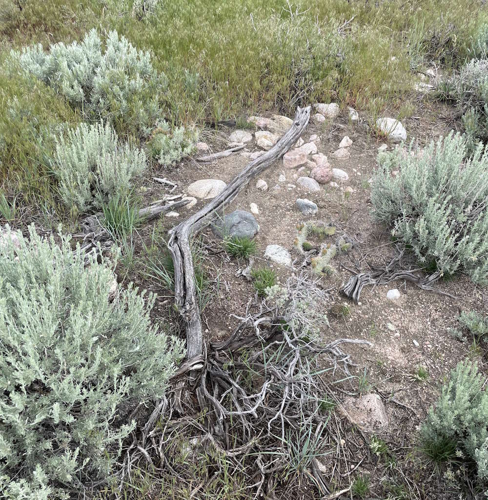
Almost immediately wagon swales are visible just beside the dirt road. Promising. About a mile and a half in, I note a pair of metal posts – fence posts really, but they’re not at an angle that parallels the property line and one is on each side of the road. Odd. Wondering what they might be marking, I hop out and wander over to have a look-see.
This is Sandy Wash and there are a lot of small cobbles in the sandy dry stream bottoms. But near the marker, there’s what seems to me to be an intentional collection of larger cobbles that stands a little higher than the surroundings. The collection is a few feet long and maybe two feet wide.
Working my way up-canyon for a couple miles, the trail as I interpret it goes up one of two side canyons. Local trail expert and historian Randy Brown has been mentioned a few times in previous posts. As far as I know there isn’t a public list of the trail markers that Randy and his associates have put out. I have no actual way to know if I’m on the original trail or not. I’m just going by what they wrote and my efforts to understand their statements 175 years later.
Nor do I know if I’m on Randy’s trail interpretation – unless I happen upon a trail marker Randy & Company put up. Nor do I know if the marked this section of trail.
It’s decision time – left canyon or right canyon?
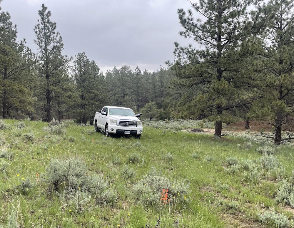
I park the truck with it’s nose pointing up the left canyon, my first choice to explore. I put a note in the windshield stating my start time, my intentions and when I expect to return. That’s for the property owners in case they come out to check on me or anyone else looking for my body. I’ve got the water camel and snack pack ready to put on – and up drives the property owners! Whew!
We talk for about 10 minutes and I ask about the canyon’s drivability. They say it’s a tad rough in places but drivable with my truck all the way to the ridgeline that separates their land from the next owner. Explaining that I don’t know for sure which of the two canyons to take, they just smile and tell me to have a good time.
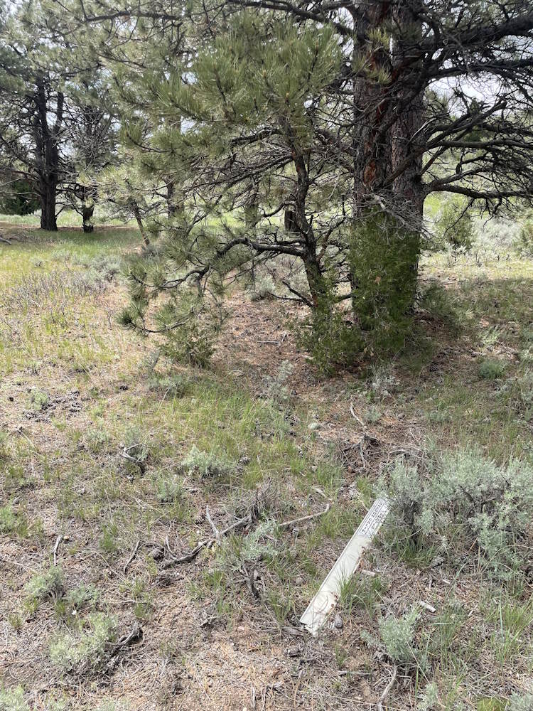
With so much possible trail to cover today, if it’s drivable, I’m all for it. Why risk a cougar chewing on my head if I can safely keep my head inside the cab? Besides, I’m alone. So, I put her in 4WD and start working up canyon. About 0.3 miles in, I stop and get out to look at what may be a swale. Nearby, broken down by the cattle and lying flat on the ground in a parallel swale is a Carsonite trail marker for the Oregon-California Trail. Woo-hoo!
It’s about 2 miles up to the ridgeline with discontinuous swales all the way up, here and there, peeking out from under trees, or missing where washed out by the infrequent flash floods that change the dry stream’s course.
It starts raining – misting really – again. Cresting out on the ridge I’m delighted to find I have good cell reception, so I call Denny – to make her jealous. The view is very nice. It would be much better and fun if my sweetie were here to share in this. And, there’s another marker crushed down by the cattle and lying flat on the ground. Across the fence is a gentle slope pasture with faint evidence of trail crossing it.