Kevin – Wednesday. Our hiking day started just west of Rock Creek by entering BLM lands, then following the marked Oregon-California-Mormon-Pony Express trail. In the 225 miles from here to Salt Lake City we’re not really expecting to find anything ‘new’ though we’re keeping our eyes open. The Battalion journals are sparse giving us few new insights and precious little description of the route. For that, we’re relying on William Clayton, Thomas Bullock and the Brigham Young pioneer group – as well as other early trail journalists.
Mostly we’re just ‘confirming’ what others have sussed out about the trail. We’re getting our exercise, having another trail experience together and trying to promote trail awareness and interest. And, we’re having fun. And it’s darn pretty out here.
The next water after Rock Creek is Willow Creek a couple miles west. We can still see the tracks of the ‘dude ranch’ wagon and its draft horses. They’re a few days ahead of us and their tracks almost make us feel like friends. One can imagine the people on the western trails felt the same way about the wagon trains moving in proximity to theirs. Lots of journal comments about visiting other groups or trying to outdo another group.
Denny and I walk down to Willow Creek to see if we can cross in our 4WD truck. I poke a stick into the mud and hit a gravel layer a few inches down. That’s good. The creek is all of 30 feet wide in two channels. That’s good. The further channel has a set of riffles – the water moving over exposed gravel, usually a very good sign for a crossing, be it wagons, handcarts or trucks. We talk about the choice to ford or go around. Fording would save many miles of driving as there isn’t another good crossing nearby.
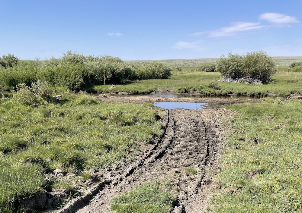
The dude ranch wagon and horses made it through. That’s a very good sign. BUT, if WE get stuck, it’s MANY miles to find someone to pull us out. No phone service here. And a tow here would be costly. IF we had another vehicle with us that could tow us out, there’s no doubt we would try to cross. BUT … the more we talk about it, the more we are in agreement to forego the ford of Willow Creek. More about that later.
We try two other possible crossings of Willow that are kind of nearby, burning over 20 miles in the effort … both to no avail. (heavy sigh) Should we go back to the first Willow crossing – the Oregon-Mormon-California-Pony Express crossing? Sure is tempting. Should we reconsider our earlier decision? Were we being too conservative?
We discuss it some more as we drive along and finally decide that ‘first impressions are usually the right choice.’ So be it. We’ll go another way – and I mean WAY as in distant.
At the southern end of the Riverview Cutoff road, we find a ranch which has all the gates open, typically a sign the owner is willing to let people pass. No one at the ranch to ask, so we head across the small bridge of Willow Creek on their property. Then we have to turn north through BLM lands and travel two miles to intersect the trail. We want to see the trail coming up out of Willow Creek, so we turn east and drive a mile to see … GASP!
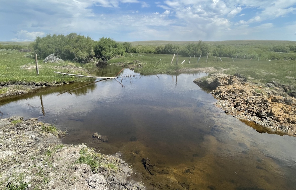
The irrigation canal which we could NOT see from the east side of Willow Creek was breached in the recent past. The repair created a deep hole which the horse-drawn wagon got through but which certainly would have swallowed our truck. Our first decision turned out to be correct after all. Had we forded Willow, we would have had to turn around (not easy with the space available) and go back across again.
1847 tie in: You know dang well the early explorers had a lot of trial and error when scouting the west. No one knew except the animals and any natives that would communicate information. With the main Battalion command in New Mexico, Col Cooke frumped in his journal that the guides had almost got the men into a cul-de-sac. Scouting and life is a lot of trail and error. You have to think using your best information, then act on your best instincts.
The rest of the day is a series of hiking trade-offs. Denny goes a distance, then me. The road/trail is two-track, infrequently used. We probably could bike some, but it’s gravelly and sandy in a few spots. We hiked 7 miles but drove a whole lot more. That’s the way this goes some days.
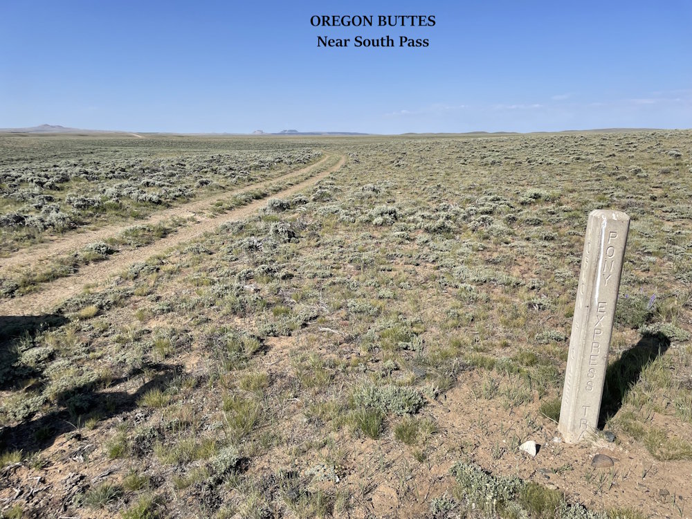
By my reckoning, we have only 9 hiking miles left to get to the South Pass. Amazing! Since we crossed the Sweetwater today we’re set to reach South Pass by noon tomorrow if we get an early start.