Kevin – Monday. As promised in yesterday’s post, we checked with the Summit County Courthouse historian, Joe Frazier, and he provided a file of the Lincoln Highway brochure and a hard-copy of the Echo Canyon tour brochure. With his permission, we provide the Lincoln Highway brochure file. We hope to have the Echo Canyon file tomorrow.
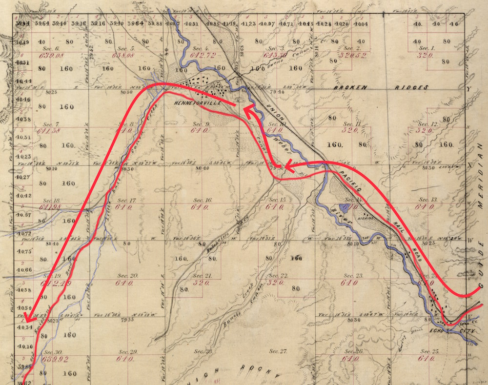
View PDF of Lincoln Highway BrochureToday we tackled East Canyon (previously known as Little East Canyon) which leads south from Henefer (previously known as Henneforville). Below is the General Land Office (GLO) map of 1871 as surveyed some 25 years after the pioneers passage. Blue is the Weber River and some streams. The red line is our best interpretation of the original trail and the arrowed red lines indicate the direction of travel. In the bottom left the trail is labeled as the ‘Old Emigrant Trail.’ Remember that the only group taking this trail before the 1847 Vanguard company was the Donner party the previous year. The wagon road was just barely a wagon trail in 1847. A lot of infrastructure had been created by 1871.
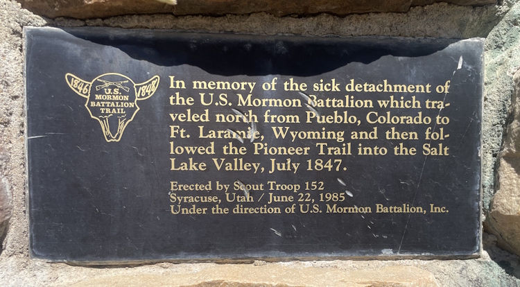
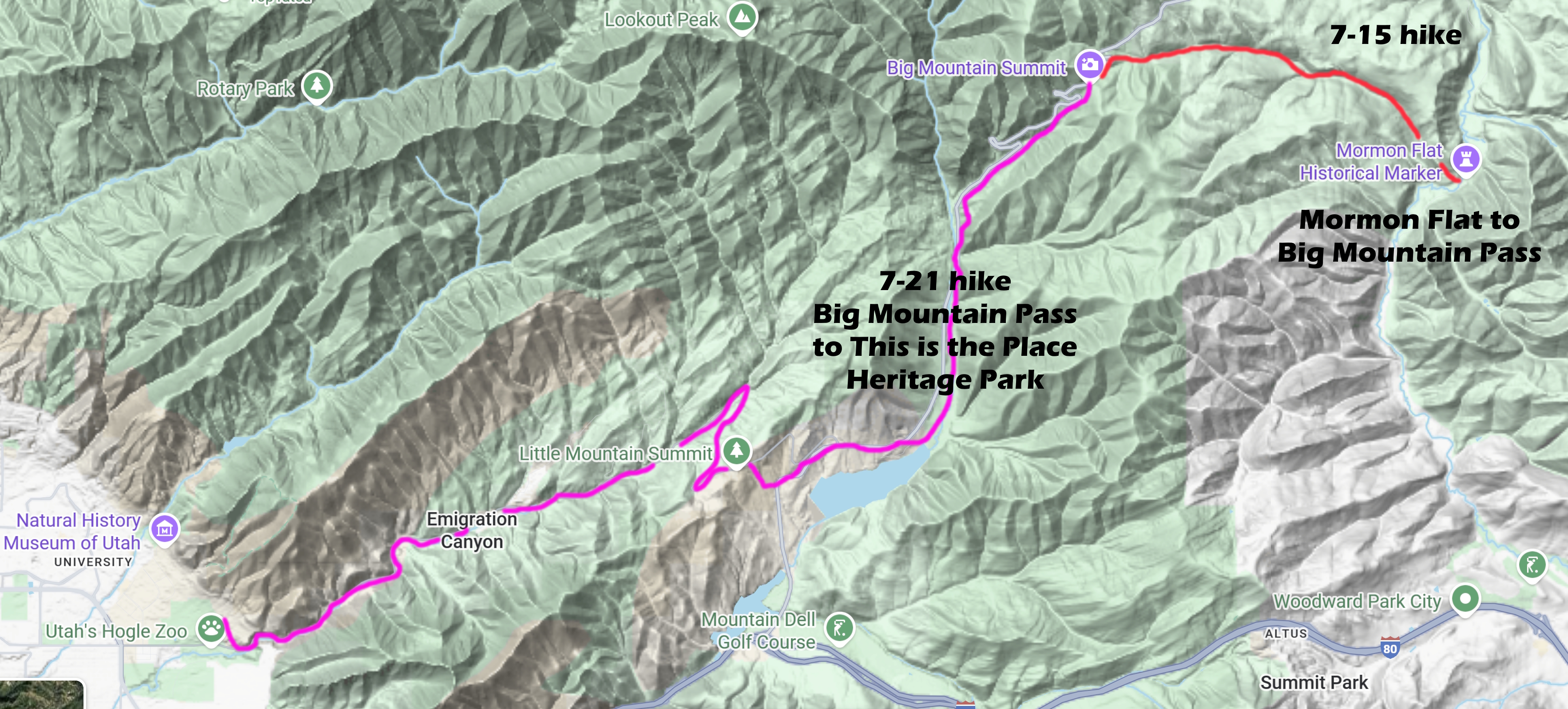
For us, it was 17 miles up into the Everlasting Hills on Utah Highway 65 to arrive at the base of Big Mountain which we will attempt to summit tomorrow. The route today was only a 700-foot increase in elevation, the majority of that in the first 6 miles. While specific spots of the original trail were seriously difficult, the nearby modern road smooths those places into a nice, fairly level route. When we arrived at Broad Hollow, one of the more difficult stretches for the pioneers, we found the following memorial plaque at the monument.
You may wonder why we are ‘ahead’ of the Brigham Young Vanguard company schedule. They arrived here on July 19. Add to that that we’re REALLY ahead of most of the Mormon Battalion detachments and Mississippi Saints who arrived here on July 26. They entered the GSL valley three days later.
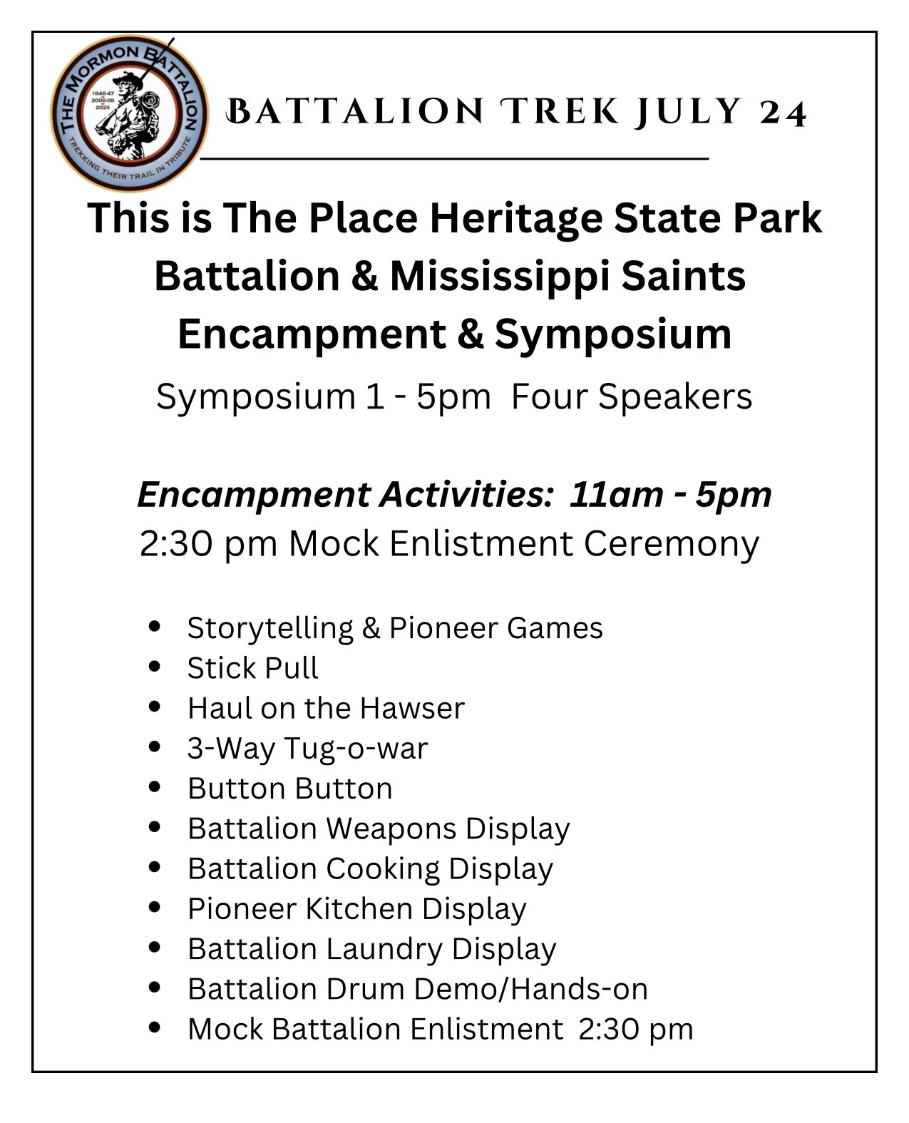
The simple explanation is that we’re not trying to follow their schedules religiously. (grin) We are sensitive to the Utah State holiday on July 24th and want to participate in those events. We are mixing up our hiking schedule for the next week to avoid interfering with other planned events. Upon the advice of our co-sponsor, This Is The Place Heritage Park (a Utah State Park), we opted to hold our symposia and encampment to coincide with the holiday.
Let us say, the planning staff at the Park have been wonderful. First class. Please drop them an e-mail of appreciation at: customerservice@thisistheplace.org
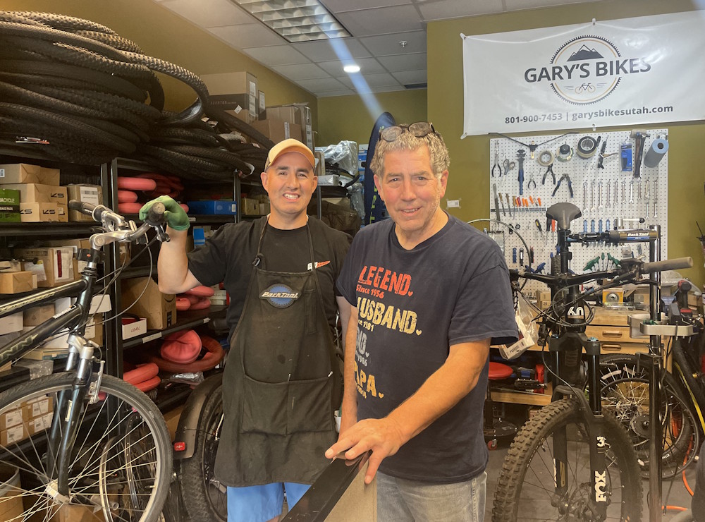
Saturday, my bike chain jumped the gears and got seriously stuck. After an unsuccessful effort to get the chain out and with other repairs needed, we decided to send Denny with both bikes to be repaired.
We want to thank Gary’s Bikes of Provo for taking us on with a quick turn-around. Our last day on the bikes will be on the 21st. We will bike from the bottom of Little Mountain down to This Is The Place Heritage Park as our ‘last hurrah.’
Journals are replete with broken wagons that are repaired by someone with the skills – out on the sagebrush prairie.
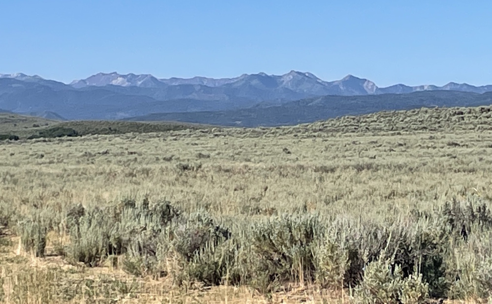
As we crested ‘Heartbreak Hill’ at the Summit/Morgan County line on a ridge, the Wasatch Range of mountains hove into view supposedly for the first time. Imagine though that you’ve already traveled some 875 miles from Pueblo not to mention the miles the prior year from Council Bluffs. Imagine that after working up the mile-long Prospect Hill, after crossing the South Pass and thankfully missing the Wind River Range by less than 20 miles and avoiding the worst of the mesas in western Wyoming, imagine cresting this ridge and seeing in front of you this view of apparently uninterrupted mountains touching the sky.
Now, to be fair, I think someone in later years made up this ‘Heartbreak Hill’ thing to sensationalize the first view of the Wasatch. And the pioneers already knew there was a usable pass through the Wasatch, so again, the story seems overblown. But still, without a personal knowledge of how bad it was going to get, your heart might just quail for a minute or two.
On the other hand, the Everlasting Hills may not mean what we think it means. For myself, I’ve always thought it meant the mountains were SO OLD that they were in essence nearly immune to erosion, therefore, ‘Everlasting.’ But now, after biking and hiking this route, perhaps instead the Everlasting Hills means that they just seem to go on and on and on and on – forever.
With that, I’ll sign off and pass the blog post with supporting photos and documents over to my erstwhile companion and help-meet, Denny Watts Henson, multiple-grand-daughter of pioneers, handcart rescue party members, and other folks who were just as strong in the faith. Tomorrow we summit the last of our Everlasting Hills if all goes according to plan.
Goodnight, Gentle Reader. Goodnight